Do you accept the use of cookies to ensure a better experience on our website?

Find out more
About us

The port in figures

On 1 January 2022 the Autonomous Port [Port Autonome] comprised 29 port sites over a total of 477 hectares (of which 330 ha are former brownfield sites). Of this surface area, 67 hectares are green zones, approaches, embankments, etc. 410 hectares are actually usable.

The alliance of water, rail and road to transport goods

Other features of the port of Charleroi:

  • 8 km of quays
  • 5 million tonnes of transported goods (including 10,000 containers)
  • A trimodal platform for handling containers
  • 100 companies in concession, 1700 direct jobs and 1000 indirect jobs

Ideally located

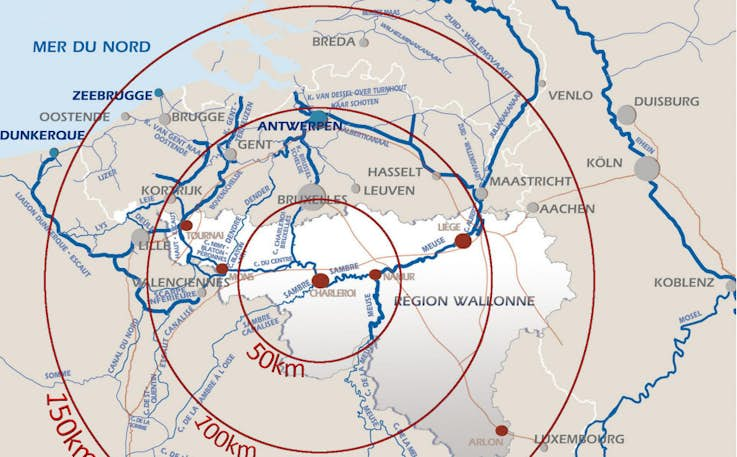
At the heart of Europe, linked to the major European transport routes

Along the Sambre and the Charleroi-Brussels canal.

Economic player in ā€œCharleroi Metropoleā€, burgeoning industrial and commercial basin with a density of 640 inhabitants/kmĀ².

PAC has 8 km of quays, of which 1.5 km are public quays with a loading zone, 3 docks, 3 rail-connected sites and a trimodal terminal with a gantry for container handling. Every year, more than 5 million tonnes of goods transit via the Port.

Interactive map

Discover the 477 hectares of the port

Find out more